
The ABC's of NAV: Navigating an RV Trip
The ABC’s of NAV: Navigating an RV Trip
Tips and apps for trip planning (especially for Big Rigs).
By: Don Cohen
A couple of years ago, we found ourselves in Indiana in the Navion with a week to kill before rendezvousing with friends. We had a couple of in-state destinations in mind, but with no real schedule or plan, I decided to play GPS roulette with the Rand McNally NAV system that gives you alternative routing options (read: no freeways). It took us down some less traveled state highways which were fun. However, when we wound up on a one-lane tractor path between cornfields in Southern Illinois, that's when I canceled route guidance and pulled out my iPhone for a second opinion.
That kind of throwing caution to the wind strategy is perfect for amping up your sense of discovery in a B-Van or Class C compact, but I cringe at the thought of trying that with a big Class A. It's the difference between a kayak and a cruise ship. Stay out of the shallows!
While a lot of the tips and secrets I'm about to share with you can apply to any RVer, when you're piloting a big rig, preplanning can avoid winding up somewhere you really didn't want to be.
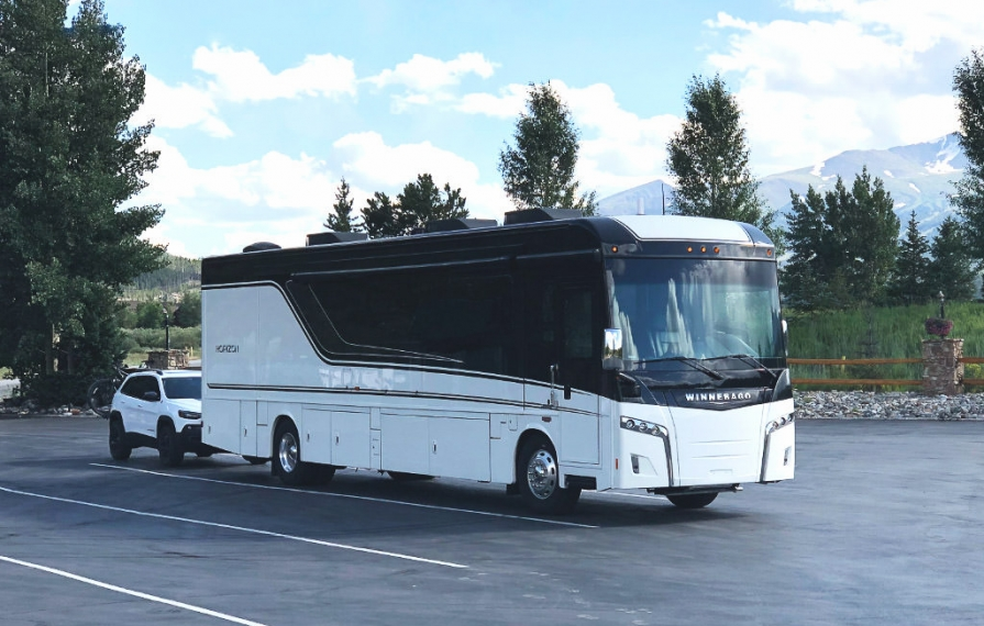
Pushing 40,000 pounds of house and pulling 4,000 pounds of car, I've become a lot more intentional in my travel planning. I want to know where I'm fueling up, where I'm staying the night, and anything adverse to the route such as dirt roads, complex exits, and narrow streets.
Start with the Big Picture
I love the 21st century and all the benefits of GPS-based mapping. But, I also love the 20th century's discoverable comfort - a large road atlas. My current fave is the Rand McNally Large Scale Road Atlas. Printed road atlases give you the bigger picture that it's impossible to get via an electronic map. It's a great way to determine the size of highways and the distance relationship between towns. Many printed maps also have small dots that run along roads indicating scenic drives. Whether in the rig, or exploring with the tow car, these scenic routes are always worth considering.
I remember on our first RV trip (a 6,000-mile whopper), we were dropping back into the U.S. coming from Ottawa. I saw a crossing over the St. Lawrence at Ogdensburg, NY, and in tiny red type the words "F. Remington Art Museum." That little discovery on the map turned out to be an absolute gem of a museum.

Illustrator, painter, and sculptor, Frederic Remington's house overlooking the St. Lawrence River in Ogdensburg, NY, and a bit off the beaten path, is a charming and intimate gallery of his work and a great example of the virtues of studying map routes ahead of time.
A road atlas is also good in helping you gauge the distance and pacing of a trip as it's easier to envision where you can make good transit time and where it's worth slowing down and lingering.
How Far in a Day?
Somewhere there's a fragment from my memory bank from when I was about ten years old, sitting in the back of the family Oldsmobile 98, bored out of my tree with nothing to look at as Kansas blurred by, and I remember my father saying, "easy day, only 550 miles to St. Joseph." That 550 number has always stayed with me and whether it's a small rig like a Navion, or a big one, like the Horizon, I always calculate that 300 miles is a short day, 500 is pretty easy, and 600 is plenty. Many big rig owners I talk to are quite content to keep their driving between 300-400 miles. Looking at a big printed atlas helps me get a more granular sense of how I may break up the legs of the trip.
Overnight Stays
When your travel plan has you driving for one or more days to your destination, you start thinking about where you're going to spend the night. The true joy of a B-Van or Compact C is that you can basically stealth camp just about anywhere. With a big rig, it's more than likely you're going to need to push one or more slides out to use the coach at night. That makes you a lot more obvious and a little more selective about where you might want to boondock. Truck stops are a mixed bag in terms of noise throughout the night and smells from diesel fumes. Rest stops are potentially a higher security risk and rarely level. Casinos can be pretty good as are Walmarts. If you travel one or more days from home on a consistent route direction (like when we head out of Colorado to either eastern or western geographies) keep your eyes out for smaller truck stops that can be close to the highway, but never too busy.
However, there are times (especially in summer when you need to run the AC all night) that it's nice to pull into an RV park and plug in. That's when I use my various software tools to look for easily accessible RV parks that are close to the highway.
Tech Tools
Once I've got a handle on the big picture, then it's time to break out all the tech for the more detailed travel planning. We travel with twos of everything: iPhones, iPads, and MacBooks. Across all our devices, we share data via cloud accounts (both Apple iCloud and Dropbox). For route planning and research, my primary hardware choice is an iPad. I tend to search more visually instead of typing in search criteria, so pinching, zooming, and sliding a map around are very helpful for discovery. However, when home, I often enjoy the 27" of display on my iMac to keep lots of windows open when trip planning.
While traveling, my laptop generally stays in its bag and most of my navigation happens with my iPad and iPhone. We also have the Rand McNally software running on our Xite infotainment system, which I keep turned on all the time when we're driving, not only for route information, but for other fast facts like sunset, altitude, and time to destination. We also have the uConnect NAV system in our Jeep Cherokee tow car which supports both Apple CarPlay and Android Auto. (When we're in an unfamiliar area, we search for a destination on the iPhone, plug it into the Cherokee and use Siri to navigate. I've found both Siri and Google maps running through CarPlay to be far more accurate than the on-board GPS navigation software.)
In the rig, occasionally heavy use of our phones and tablets can be battery drainers. Our Horizon has several USB charge points up in the cab and we keep a couple of longer 4-6 foot charging cables handy. I'm a big fan of Anker USB cables which are available from Amazon because of their durability and quality of finish.
Having a printer is also helpful. For a long time, I used a Canon portable inkjet because of its diminutive size. When we stepped up to the Horizon, I knew I'd have a little more room for a laser printer. For infrequent use, I'm not an inkjet fan because of the tendency of the expensive cartridges clogging. A black and white laser printer is faster and more dependable - however, size is always an issue. Concurrent to getting our new Horizon, HP conveniently introduced an outstandingly small and super affordable laser printer. The LaserJet Pro M15w is a wireless gem and remarkably small. It's less than $100 and the toner cost is a lot less than inkjet. Total winner.
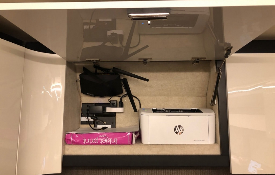
The HP M15w fits perfectly in our front overhead bin. Even better, our prototype Horizon had a 110v outlet installed making it easy to plug the printer in along with a King Antenna WiFi directional antenna system.
There's an App for That
So, let's rummage through my digital toolbox and see what apps might best fit your needs. Here's a list of all my little navigation helpers:
- Rand McNally (built-in)
- AllStays (iOS, desktop)
- Overnight RV Parking (iOS, Android, desktop)
- Google Maps (iOS, Android, desktop)
- Apple Maps (iOS, MacOS)
- RTP (iOS, MacOS)
- iExit (iOS, Android)
- Co-Pilot (iOS, Android)
Rand McNally and Garmin
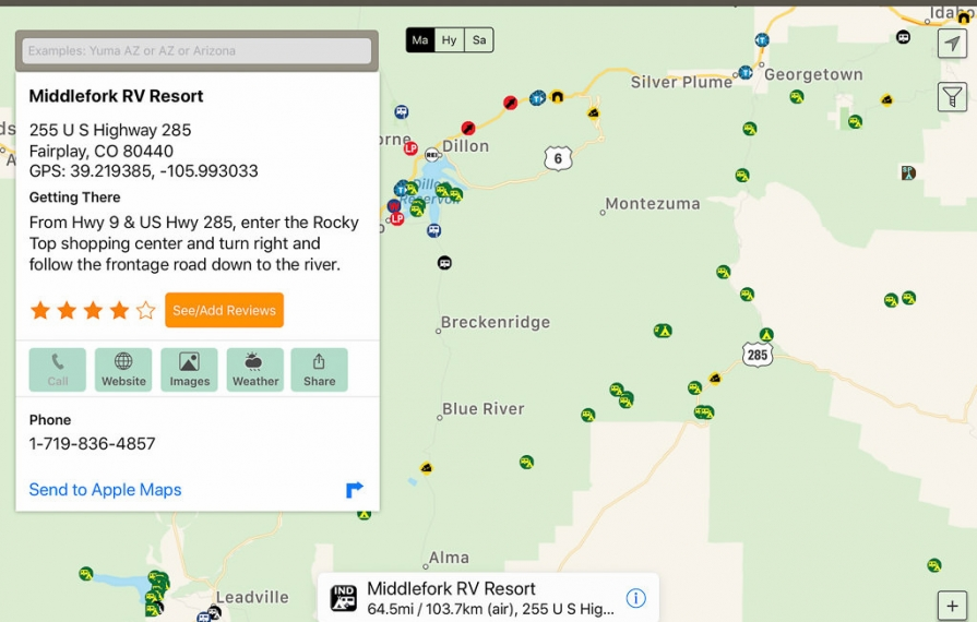
Both companies make RV software that has unique information and routing guidance for big rigs (clearances, weights, etc.). These are integrated hardware/software products - you can't download them into devices like phones and tablets. The Rand McNally software comes with the Xite infotainment system and, over the years, I've become a real fan. But that didn't come without a lot of frustration and pain. It's the least intuitive of RV navigation products, but once learned, it's highly capable and its extensive databases of campgrounds and services is robust.
If you don't have an Xite system, you can buy an RV version of the Rand McNally software that comes preloaded on a dashboard mountable display. The same holds true of Garmin's RV offering. The Garmin software is a little easier to use, but doesn't have some of the deeper database underpinnings as Rand. Nonetheless, you can't go wrong with either -- just plan on spending some frustrating time trying to learn where features are tucked away and how to access them.
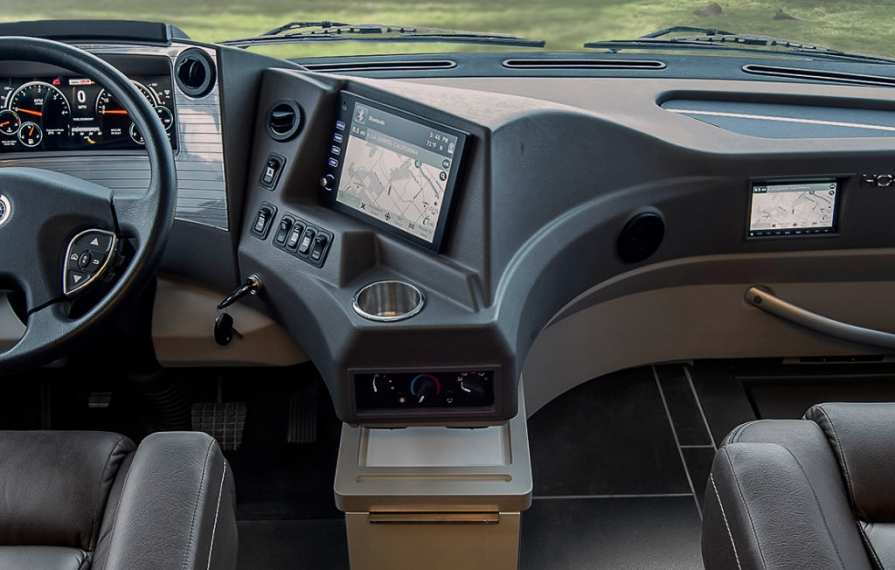
The Xite Infotainment System is our key navigating tool while driving. There's a second screen for the passenger that can also be used to access the rear camera, search the GPS database, and change channels for the SiriusXM radio.
AllStays
THE gold standard. We love it and swear by it. Forget buying anybody else's campground directory. This is the one. It has a huge database of commercial and free camping locations and a ton of other information. Sorry Android users - you need to access AllStays through a web browser versus an app (but it's still very useable). For planning, I like to use AllStays on my iPad where I can see more of a map displayed. Going down the road, Terry prefers the iPhone version where she can search and call for reservations. At $9.99, it's an exceptional value because that's a one-time purchase and the app's database is frequently updated.
The Allstays app is the single most comprehensive database for RV camping and services.
Overnight RV Parking
This app costs $25 a year and, if you use it to find free parking for just one night, it will have paid for itself. While it doesn't have the polish of AllStays, its visual database is really quick to understand and, through a reward program, it incentivizes users to post up-to-date detailed information of where to stay for free or lower cost. If you do a lot of boondocking, this is also a must-have app in your toolbox.
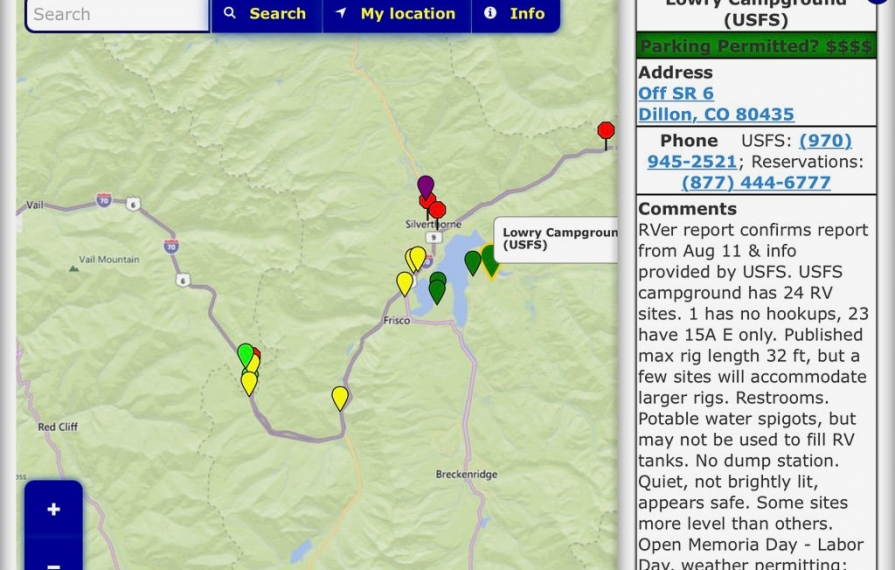
ORP distinguishes itself with detailed user reports of overnight parking locations. Users often describe the best areas of the parking lots and other nearby tips.
Google Maps and Apple Maps
Both of these are free. If you're an Android user, then you'll use Google Maps. For Mac and iOS users, you get the advantages of both. Apple's strength is its deep integration into other apps and devices (like hearing and feeling turn directions on your Apple Watch). Google Maps definitely gets extra points in showing bike routes. On a computer, Google Streetview continues to expand to the point that they've driven tens of thousands of miles photographing entire routes. I recently "followed" a highway into Northern New Mexico for 100 miles where I wanted to make sure that the road was suitable for a wider big-rig (sure enough, it was).
I also find that viewing by satellite imagery (Google Earth, Google Maps, Apple Maps) is enormously helpful in reducing travel anxiety. Looking at intersections (for wide turns), entrances to shopping malls and truck plazas, and campground layouts are all locations where satellite photos have helped me plan better strategies and reduce unexpected surprises.
RTP (Road Trip Planner)
While most GPS software programs will map out a full trip route, it's nice to be able to break down each leg. Google Maps lets you add multiple locations, but it won't calculate the distance between them. RTP does. And, for a few bucks for the app, I found it very good in determining leg distances which helped me determine where to look for overnight camping at the end of a day's drive. I could see where my options were if I were going to drive eight hours or push on for ten.
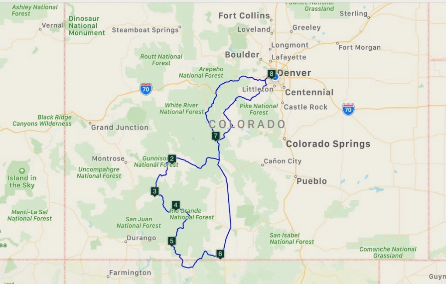
RTP is an inexpensive app that can measure distances of each leg of a trip. It's a very handy tool for mapping out a complex travel itinerary.
iExit
This nifty app tells you what's coming up at freeway exits ahead of you. It shows restaurants, gas stations, hotels, camping, and hospitals. It's hugely helpful when you're calculating fuel distances and also looking for truck-friendly stations. While I don't use iExit for pre-trip planning, it's a trusted companion when we're rolling. My only wish is that it worked on non-Interstate highways.
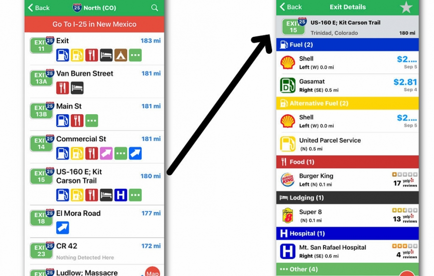
iExit gives you a rolling display of what's coming up at Interstate exits ahead. Tapping on an exit displays all the services available including gas prices.
Co-Pilot
For a $29 per year subscription, Trimble Navigation's app essentially turns your smartphone or tablet into a standalone GPS unit. It downloads 2.3GB of mapping data so, like built-in nav systems it doesn't require a cell signal to work. Online reviews of Co-Pilot have been mixed, but I chalk that up to users who may not be super GPS savvy. While it falls short of either Rand McNally or Garmin in the depth of its database, it's still quite capable. Some definite plusses are that it will give you different route options and also search for campgrounds along the way near the route (a lot like iExit's "distance to." display feature). It also provides turn-by-turn directions.
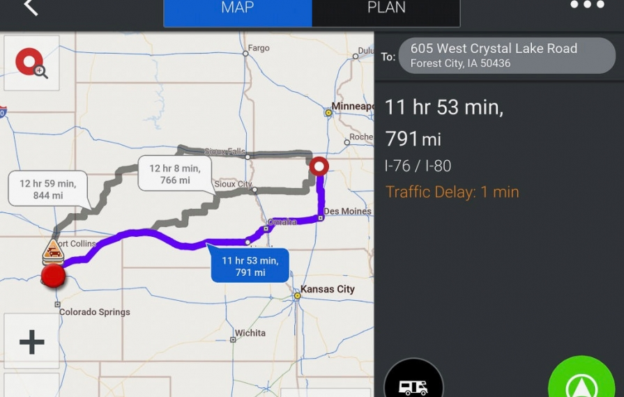
Co-Pilot is a full-on GPS navigation software for a smartphone or tablet. It quickly calculates multiple route choices.
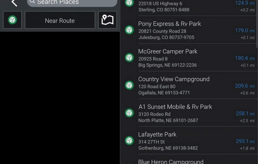
Co-Pilot has a very nifty feature with the ability to display a list of campgrounds close to the route you've selected. However, it falls a bit short in its database of available properties and doesn't show all the options that might be available.
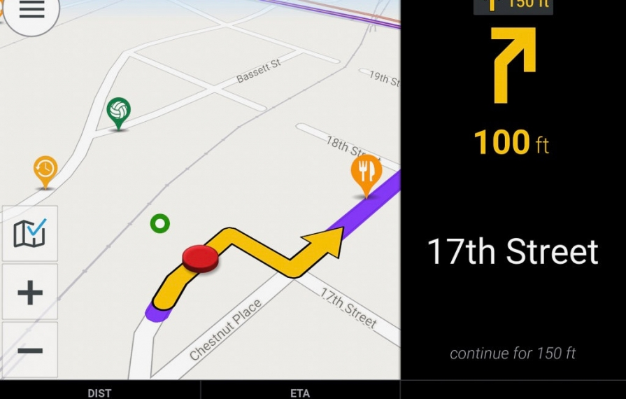
Just like built-in or standalone nav systems, Co-Pilot will give you turn-by-turn directions.
The more you know, the more relaxing the trip
Learning to use all these planning tools has definitely helped lower my driving anxiety by reducing surprises. However, I still believe that one of the true joys of RVing are the unplanned moments of serendipity and discovery that you didn't expect. Sometimes you just have to stop and smell the cornfields, pine trees, and ocean. Good planning will get you comfortably from point to point, but it's all the cool stuff in between where the magic lives.
Comments
Comments on this post are moderated, so they will not appear instantly. All relevant questions and helpful notes are welcome! If you have a service inquiry or question related to your RV, please reach out to the customer care team directly using the phone numbers or contact form on this page .