
Immersed in Western History & Geology in Arizona
Within a small area just west of the Arizona-New Mexico border, and just south of Interstate 10, there is a great place to immerse in Western history while enjoying the natural landscape. This area voices the history of the native lands of the Apache, the arrival of the stagecoach, and the U.S. Army and their establishment of Fort Bowie.
Staying at Chiricahua National Monument
We started this journey with a number of days and nights at Chiricahua National Monument. Exiting the interstate at Wilcox, Arizona, we drove across prairie being ranched as it has since the first settlers arrived following the Civil War. Driving through a rather mundane landscape, we were wondering how great this National Monument would be to camp and explore. Then we saw the rock formations coming into view. Wow!
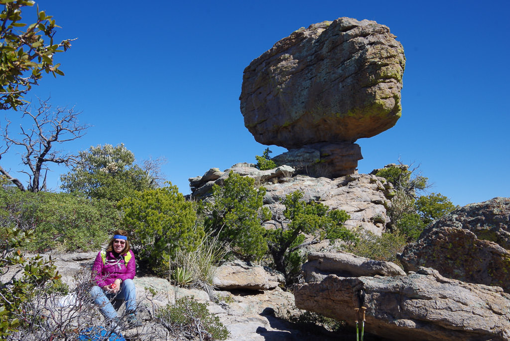
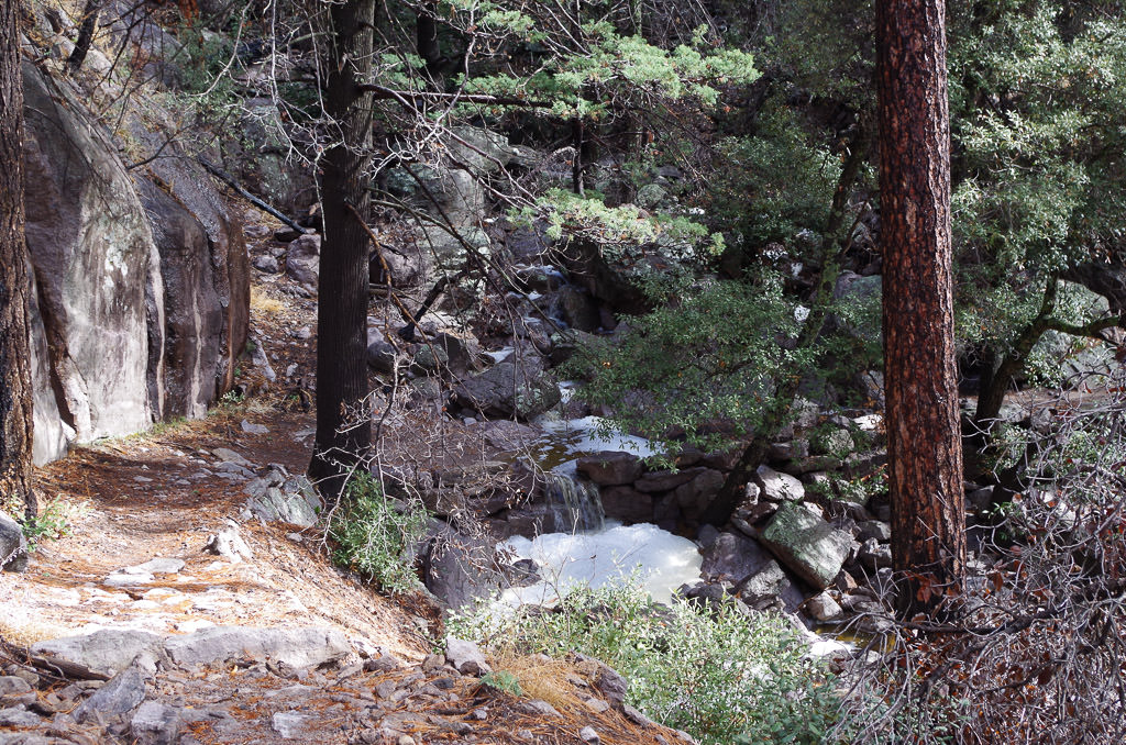
Chiricahua, "Wonderland of Rocks", was developed by the Civilian Conservation Corps in the 1930s as a project for the local youth of the area. Today, much of their efforts are still present. The 17 miles of trails cut through the rock cliffs and rhyolite formations, the river rock buildings, and many of the picnic grounds are all still in use.
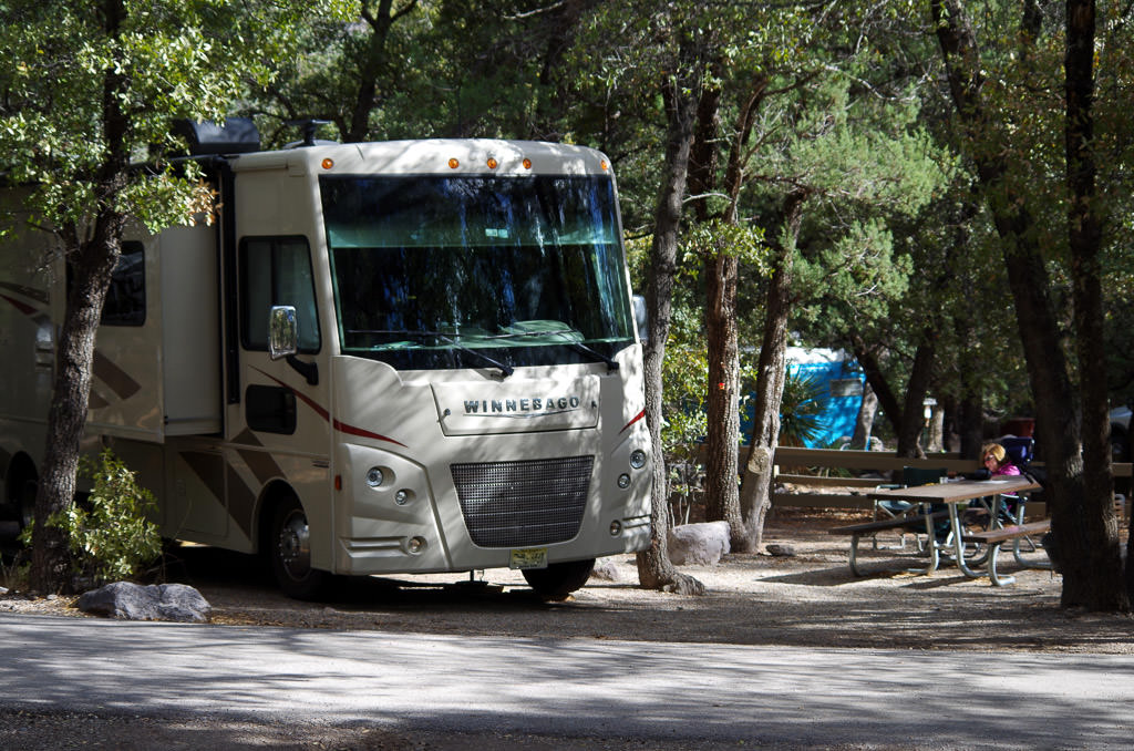
We entered the Monument and headed directly to Bonita campground to secure a site. With our 31-foot Winnebago a little longer than the stated limit of 29 feet, we had done some prior research and knew the sites that we would fit into. We arrived at our campsite and backed into a perfect spot shaded by the local cottonwood trees. Although rustic, this campground is lovely with its river rock buildings and shaded sites. There are no hookups, nor a dump station, but there are your typical National Park type bathrooms with flush toilets.
Exploring the Area
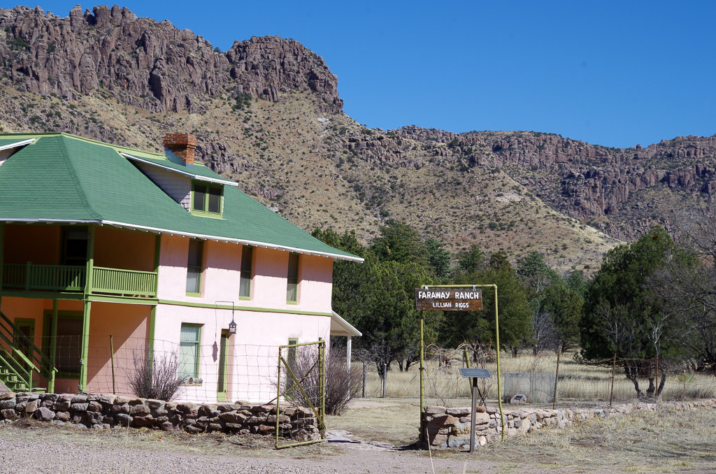
Once settled into our site, we walked over to the Visitor Center, along a .25-mile trail. It was time to plan our adventures. The Visitor Center begins the discussion of this land and its players, the Apaches, the ranchers, and the U.S. Army, through its displays and available books for purchase. There is also an excellent video depicting the settlers of the area including the nearby Faraway Ranch, open for visits (limited schedule), and the monument's development by the CCC.
One of the great assets of this monument is the daily shuttle, that takes hikers up the eight-mile paved scenic road to Masai Point, a trailhead at the top of the formations. We used this shuttle for two of our hiking days; starting our hike at the top and working our way down through the incredibly crazy formations, ending back at the Visitor Center.
On our hikes, we saw the hard work done by the CCC to make this area accessible. They developed the trails, named, and signed many of the rock formations. Walking the trails and having read the history of the area, we better understood how the Apache lived in this area. Water was available from the many natural springs that we passed, and the volcanic rock formations were great places to get protection from the weather, and later to hide from the U.S. Army when hostilities started.
Side Trip to Fort Bowie
We also took a day trip to Fort Bowie National Historic Site to further understand the history and explore more of this interesting country. We elected not to take the 30-minute dirt road leaving from near the entrance of the monument and traveling through Apache Pass. Instead, we drove back to Wilcox, headed eastbound on I-10, exited at Bowie, and drove to the Fort (90 minutes).
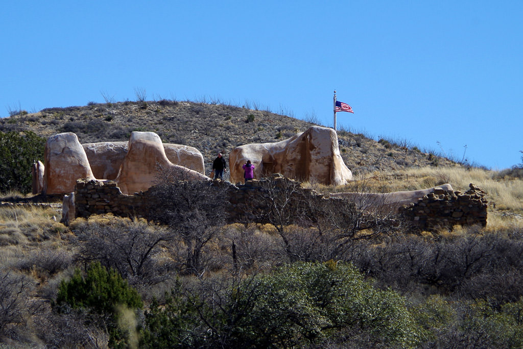
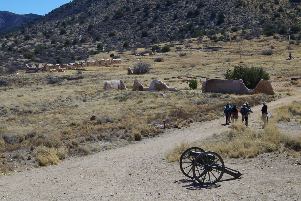
Fort Bowie is the only National Historic Site that cannot be reached by car/RV. We parked our motorhome at the trailhead and joined a park ranger for a very informed narrative on the 1.5-mile trail to the Fort and the Visitor Center. Walking this trail furthered our understanding of this area's conflicts. In addition to passing a natural spring, we crossed over the Butterfield Overland Stage Coach trail and viewed one of its "rest" stops. Continuing, we reached the remains of Fort Bowie, and an excellent Visitor Center.
We learned that at first, the Apaches allowed the pioneers and gold rush Forty-niners to pass through their land. They even accepted the Butterfield Overland Stage Coach, as it barreled through their tribal lands on its 24-day 2,800-mile trip from St. Louis to San Francisco. During this time the Apaches were mostly at peace and even offered supplies to the Stage Coach. But when Cochise and his band were accused falsely in 1861 of ransacking a local ranch and kidnapping a young boy, war started. For the next ten years, death and destruction came to southern Arizona. Fort Bowie was built to protect the local ranchers and travelers on their way to the west coast. The hostilities ended when Geronimo surrendered and was removed to prison in Florida.
Following our day at Fort Bowie, we headed back to Chiricahua to continue our enjoyment of this unique country with its strong western history. What a fascinating place!
Comments
Comments on this post are moderated, so they will not appear instantly. All relevant questions and helpful notes are welcome! If you have a service inquiry or question related to your RV, please reach out to the customer care team directly using the phone numbers or contact form on this page .